


SmartNet SmartPointFinder allows to record, manage and search geographic positions with the possibility to associate further information as descriptions, categories and photos.
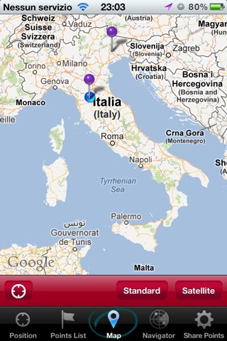
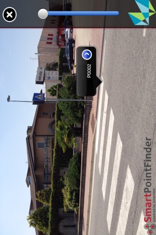
The research and visualization of the position of the points is made using the augmented reality and the visualization on the map.
The coordinates of the positions are shown also as UTM coordinates.
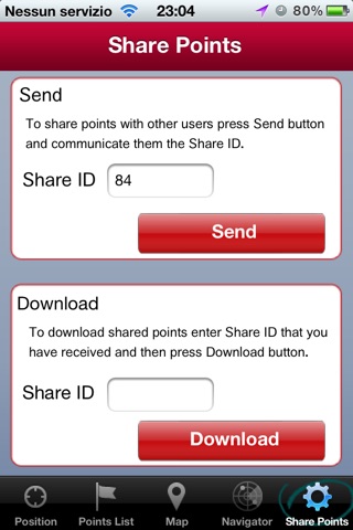
The Save & Share option allows, with a single click, to send to other users the acquired positions for a total information sharing.
Important news are coming soon on SmartPointFinder, making it an irreplaceable application for everyone needs to manage geographic positions! Keep yourself updated!